3D Insight
Immersive Spatial Intelligence for Energy Infrastructure
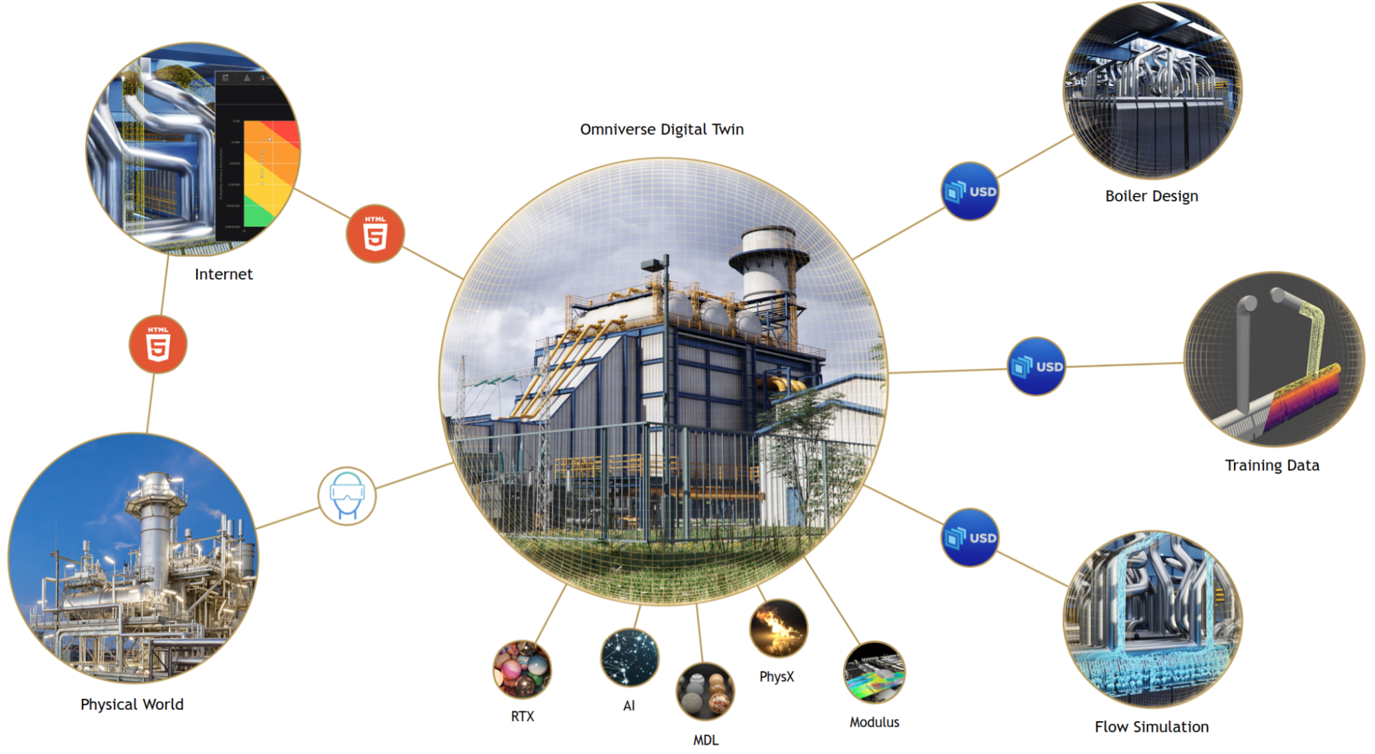
OpSys 3D Insight creates photorealistic, data-rich 3D models of energy infrastructure — substations, solar farms, wind parks, and industrial plants — by fusing drone photogrammetry, LiDAR point clouds, and BIM models with live SCADA data. Engineers and operators navigate a true digital twin in 3D, with real-time asset status overlaid on the spatial model.
Key Capabilities
Photogrammetry & LiDAR Fusion
Process drone imagery and LiDAR point clouds into centimetre-accurate 3D models of any energy site.
Live SCADA Data Overlay
Real-time asset status, measurements, and alarms overlaid directly on the 3D spatial model.
BIM Integration
Import IFC, Revit, and AutoCAD 3D models for greenfield projects and merge with as-built survey data.
Virtual Walkthrough
Browser-based and VR-compatible immersive walkthrough for remote site inspection and operator training.
Clash Detection
Automated detection of physical clashes between new equipment designs and existing infrastructure.
Change Detection
AI-powered comparison of sequential drone surveys to detect structural changes, vegetation encroachment, and equipment movement.
Why Choose OpSys 3D Insight?
- Eliminate physical site visits for routine inspections with immersive remote walkthrough
- Reduce engineering rework by 30% through 3D clash detection before construction
- Train operators on realistic 3D site models without travel or safety risk
- Detect structural degradation and vegetation encroachment with automated change detection
- Integrate with OpSys iDTMS for a complete operational and spatial digital twin
- Improve emergency response with real-time 3D situational awareness during incidents
Technical Specifications
- Input Formats
- Drone imagery (JPG/RAW), LiDAR (.las/.laz), IFC, RVT, DWG
- Point Cloud Density
- Up to 500M points per scene
- Accuracy
- < 2cm RMS with GCP-controlled photogrammetry
- Rendering
- WebGL 2.0, Three.js, optional VR (WebXR)
- SCADA Integration
- OPC-UA, REST, IEC 61850 for live data overlay
- Deployment
- Browser-based SaaS or on-premise server